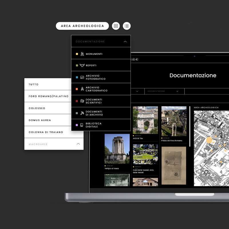
Lapis Niger’s area digitalization and analysis software
The Lapis Niger, discovered by Giacomo Boni in the 19th century, is one of the few surviving parts of the Comitium area, a place for political and religious gatherings preceding the Roman Forum. Furthermore, this site had a religious significance as an ancient and pagan place of worship that could date back to the 8th century BC. Beneath the area they discovered a sanctuary where stands a stone with one of the oldest Latin inscriptions in the world.
Under the direction of the Superintendence, Visivalab joined the cross-disciplinary scientific research project in the area. The project’s goals ranged from the study of previous historical documentation to the digital acquisition of the Comitium area, the Lapis Niger, and the inscription itself –prioritizing the preservation of the monuments at all stages. Additionally, we developed an online software to process the information, resulting in a new tool for interpreting the excavation and the context of the Roman Forum.
CLIENT Soprintendenza per il Colosseo e l’area archeologica centrale di Roma
YEAR 2012-2015
FEATURES
- Digitization of archaeological heritage
- Research and digitization of documentary heritage
- Photogrammetry and laser scanning with safe techniques
- Development of an online software for data analysis
- Development of modular and interpretative 3D models
- Comparative analysis of the historical documentation and the digital surveys
- Heritage preservation
- Dissemination of scientific research
Project
The methodology covered different approaches and stages. We began with a thorough investigation of all the historical documentation related to the Comitium and Lapis Niger. Next, we digitized the area and its monuments, using state-of-the-art acquisition technologies, and then analyzed and compared the gathered data with the historical archive. Simultaneously, we implemented an online platform that allows segmenting and organizing the raw data into infinite possibilities, thus providing an extensive database for current and future research.
REINTERPRETING THE HISTORICAL DOCUMENTATION
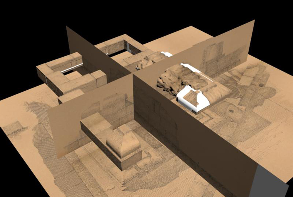
Prior to the project, we had access to a significant amount of material from the excavations conducted by Boni and Romanelli, which had been digitized at Palazzo Altemps with the ARCHEOLECTIO. However, this documentation needed to be reviewed and reinterpreted in order to provide historical and topographical context for the monuments. This study was essential for the safe digital acquisition and for comparing the digital surveys with historical data. It also allowed us to texturize the three-dimensional models with the archaeologists’ drawings.
DIGITALIZACIÓN DEL PATRIMONIO
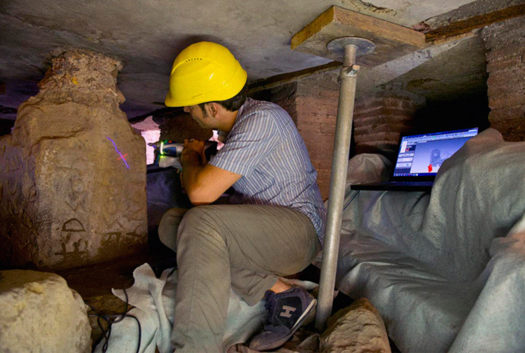
Due to the fragility of the Comitium’s structures and the challenging access and low lighting in the area, one of the main challenges was the use of appropriate technologies and techniques for the preservation of the monuments and their archaeological context.
- Comitium’s area digitization
- Lapis Niger digitization
- Stone’s inscription digitization
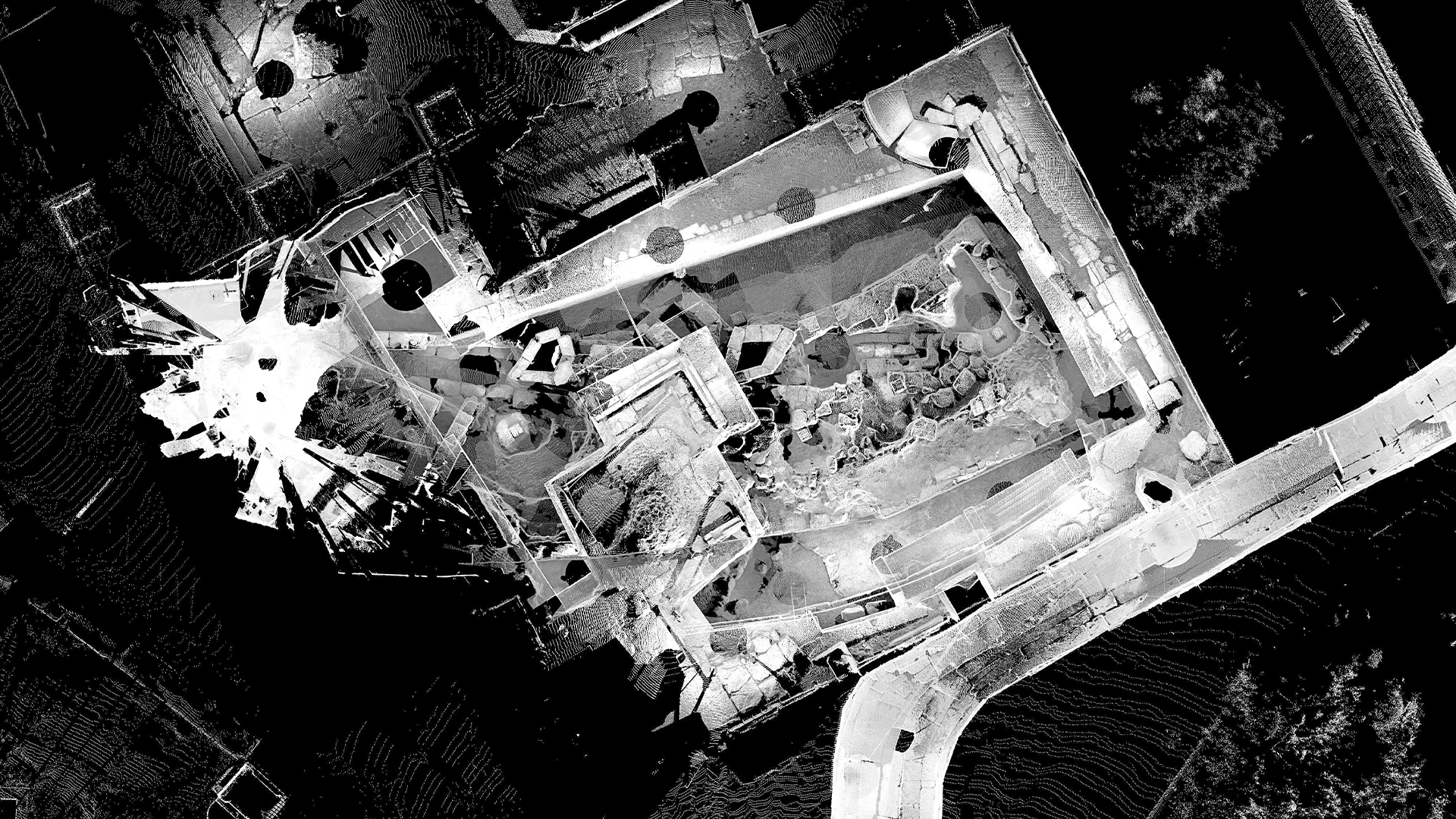
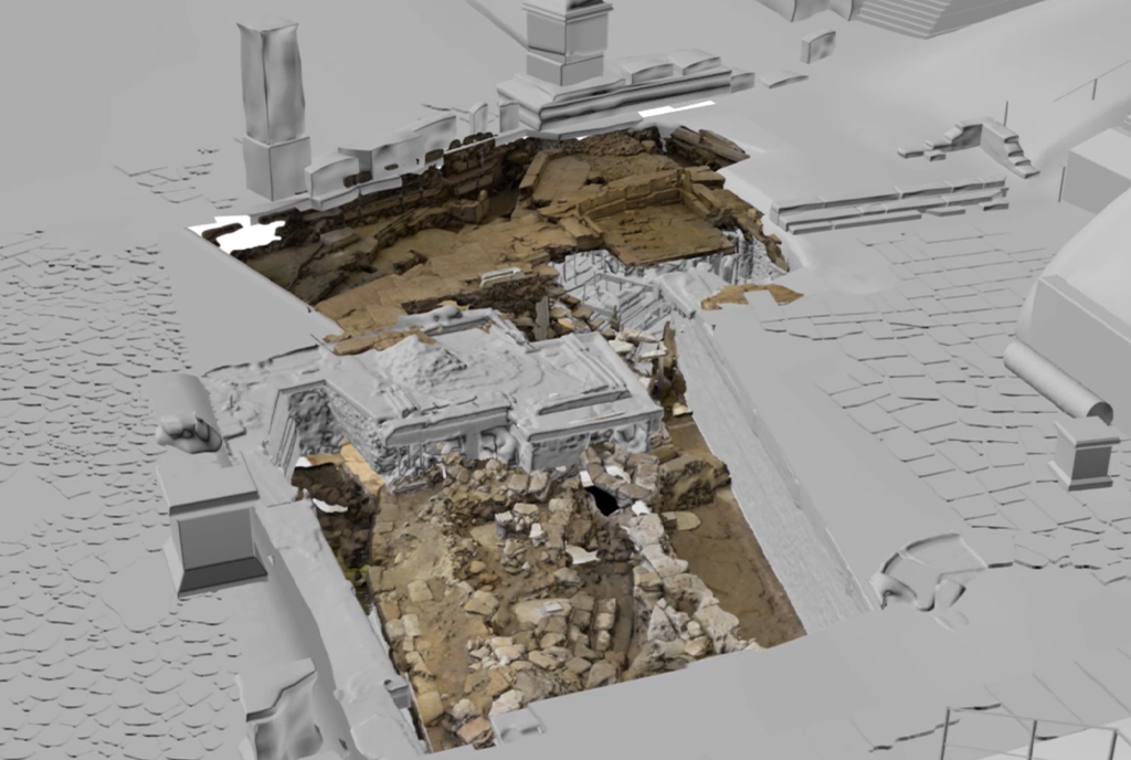
We focused on documenting the relationship between the space and the stratigraphy of the historical phases of each monument in the Comitium area, underground spaces, and conduits of the Cloaca Maxima. In order to achieve this, we created a faithful digital replica of the excavation phases using photogrammetry and laser scanning techniques combined with controlled lighting. The result was a series of high-resolution digital assets, including orthophotos, meshes and point clouds, that were subsequently compared to the historical documentation.
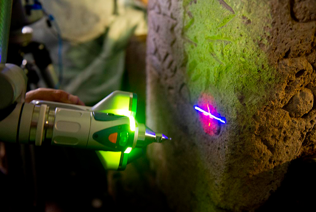
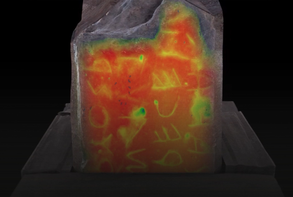
The second research line focused on laser scanning the Lapis Niger inscription using CAM2 Arm technology. We obtained a digital model of the stone through a high-resolution point cloud, which was then processed in a web platform designed specifically to study its features in detail, with specialized tools for analyzing incisions and engravings.
ONLINE SOFTWARE
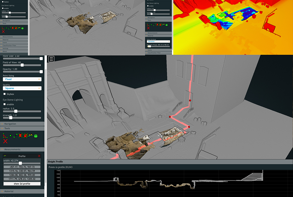
One of the project’s particularities was the development of a custom-designed online platform for analyzing the acquired data related to the monumental complex. Thanks to this platform, the entire team could work and access the documentation remotely and simultaneously without being constrained by the limited dimensions of the spaces.
The platform offers various functionalities, such as creating depth maps, extracting sections, measuring, segmenting, and layer selection. Furthermore, it allows data visualization in both 2D and 3D, preserving the three-dimensional models that are traditionally converted into 2D to support archaeological research.
3D MODELS
The result of the project is an interpretative model of the whole complex that can be infinitely decomposed into structures, components, and archaeological phases. It also allows to filter the visualizations by chronology, function, or construction technique, among others. Thus, the three-dimensional models produced serve as the foundation for the potential development of new research lines.
Lastly, the models can be used for creating multimedia content for scientific dissemination, as an example, the videos for the exhibition “Dalla Matita al Pixel” organized by the Superintendency with the aim of showcasing archaeological documentation processes and the dialogue between past and present techniques.


